Bartlett Metra Station: Commuter Connectivity in Bartlett, IL
Bartlett Metra Station is a key commuter hub linking Bartlett, Illinois, with downtown Chicago and other suburbs along the Milwaukee District West (MD‑W) Line. Its location, schedules, and surrounding land use make it central to how many residents structure daily travel.
Overview of Bartlett Metra Station
The station sits in downtown Bartlett on Metra’s MD‑W Line, connecting the village to Chicago Union Station to the east and Elgin and Big Timber to the northwest. It lies roughly 30 miles from downtown Chicago, with typical travel times of about one hour depending on the train.
Weekday and weekend trains serve Bartlett throughout the day, with extra focus on morning and evening peak periods. This supports traditional office workers, shift workers, and occasional riders who combine rail trips with driving or other local modes. Ridership levels place Bartlett among the more heavily used non‑downtown stations on the system, underscoring its importance as a regional access point.
Local Connectivity and Daily Travel
For many residents, the station functions as a multimodal hub rather than a stand‑alone stop. Riders from nearby neighborhoods often walk to the platforms, while many others drive from within Bartlett or neighboring suburbs and park before boarding.
Parking is a major factor in how commuters use the station. Nearby lots typically offer a mix of permit spaces for regular riders and daily‑fee spaces for occasional users. Weekday payment requirements, free parking periods, and quarterly permit options all influence how residents plan their commute costs and routines.
Station Layout and Surroundings
The station area includes the passenger platforms, adjacent parking lots, and a grid of downtown streets. Within about a quarter‑mile radius, many homes, civic buildings, and local destinations sit within walking distance of the tracks.
In the mid‑2000s, Bartlett replaced an older depot with a modern station building designed to meet current accessibility and safety standards. The original 19th‑century depot was preserved and converted to a small railroad‑focused museum, linking present‑day service to the village’s historic relationship with the rail line.
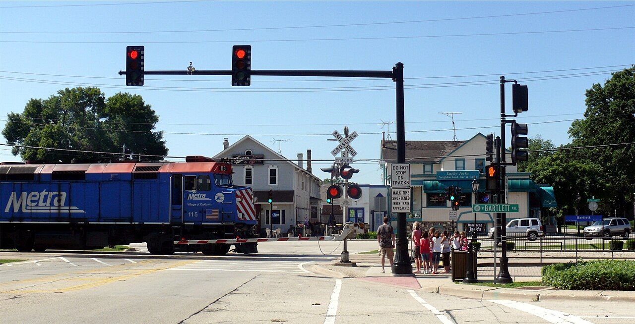
Image credit: Jacob G., CC BY-SA 2.0, via Wikimedia Commons
Commuter Patterns on the Milwaukee District West Line
The Milwaukee District West Line runs from Chicago Union Station through western communities such as Elmwood Park, Franklin Park, and Bartlett, ultimately reaching Elgin and Big Timber. The line mixes local trains, which stop at every station, with limited‑stop or express runs that shorten travel times for riders coming from outer suburbs.
Inbound trains from Bartlett to Chicago start early in the morning and extend into the evening, allowing for different start times and flexible work schedules. Outbound trains from Chicago follow a similar pattern so residents can return after standard office hours, night shifts, or evening classes. Because schedules are fixed and publicly available, many riders coordinate driving, parking, or walking around known departure times rather than variable highway conditions.
For drivers, rail offers an alternative to using expressways such as I‑290 and I‑90 during peak congestion. This is particularly relevant for Bartlett residents who balance commute time, fuel costs, and the stress of rush‑hour traffic when choosing between driving and rail.
Transit-Oriented Development and Land Use
The presence of the station has shaped how Bartlett plans and zones the downtown area. With support from regional agencies such as the Regional Transportation Authority (RTA) and the Chicago Metropolitan Agency for Planning (CMAP), the village has pursued a transit‑oriented development (TOD) strategy around the Metra stop.
Transit‑oriented development encourages a mix of multi‑family housing, retail, offices, and public spaces within walking distance of transit. Updated zoning near the station aims to make it easier to build homes and mixed‑use buildings close to the platforms and to improve sidewalks, crossings, and streetscapes. CMAP and similar agencies emphasize that concentrating growth near transit can increase ridership, reduce vehicle miles traveled, and support better regional air quality by shifting some trips away from single‑occupant vehicles.
For Bartlett residents, these policies can mean more walkable access to daily services, fewer long car trips for every errand, and a more active downtown core. Even drivers who continue to rely on personal vehicles can benefit when some trips shift onto rail, easing pressure on local roads and intersections.
Climate, Weather, and Seasonal Commuting
Bartlett’s climate mirrors that of northeastern Illinois: cold, snowy winters; warm, humid summers; and variable spring and fall conditions. Winter brings snow, ice, and freezing rain, which can complicate highway travel and increase crash risk. In summer, heat and heavy storms can slow traffic and affect visibility.
These seasonal factors shape how residents use Bartlett Metra Station. During winter weather, some commuters choose commuter rail as a more predictable option than driving the full distance into Chicago. Federal and state transportation and environmental agencies often note that shifting trips from single‑occupant vehicles to transit can help reduce emissions and improve regional air quality, especially on days when weather conditions trap pollutants near the ground.
In warmer months, comfortable sidewalks, good lighting, and bike facilities around the station encourage more people to walk or cycle for the first and last mile of their trips.
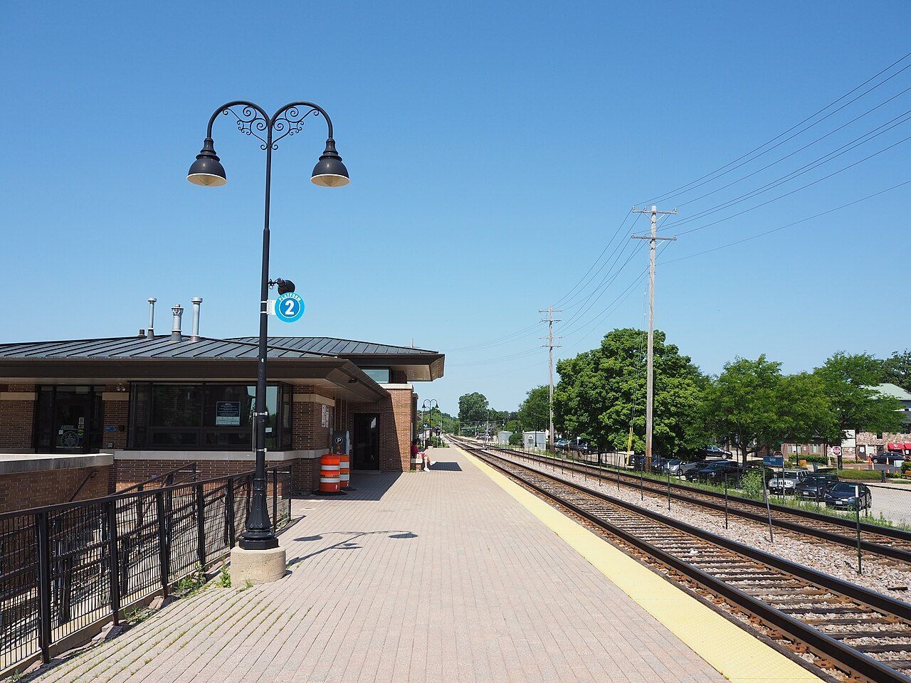
Image credit: David Wilson, CC BY 2.0, via Wikimedia Commons
Accessibility, Fares, and Regional Coordination
Bartlett Metra Station is part of a wider regional transit network overseen by the RTA, which coordinates Metra, CTA, and Pace. This coordination helps align train schedules with bus routes and provides consistent policies across agencies.
Fare programs shape who can use the station affordably. The RTA administers reduced‑fare permits for eligible seniors, people with disabilities, and other qualifying groups, lowering the cost of regular Metra trips. Local information channels help residents understand eligibility rules and application steps.
Parking payment systems near Metra stations have gradually moved toward pay‑by‑plate, pay stations, and mobile apps. In Bartlett, a combination of quarterly permit options and daily parking supports both frequent commuters and occasional riders, letting households adjust as work schedules and travel needs change.
Bartlett Metra Station in Community Life
The station area also serves as a visible anchor for Bartlett’s identity. The preserved historic depot highlights the village’s origins as a rail stop and keeps that history present for current residents. At the same time, the modern station building, surrounding streets, and evolving downtown reflect current investments in mobility and land use.
Ongoing planning efforts around the station focus on comfortable public spaces, safe pedestrian access, and land uses that bring people downtown throughout the day. As transit‑oriented development policies and infrastructure projects continue, Bartlett Metra Station is likely to remain a focal point for how the village balances car use, rail access, and walkable neighborhoods in the future.